Google Maps: intercity bus-Connections view
Long-distance buses, such as Flixbus will have an ever greater competition, to train and co. recognized by Google and therefore all the currently available Flixbus-Links in Google Maps integrated However, the new Feature is only indirectly visible.
- First step is to call Google Maps in the Browser or use the free Google Maps App for Android or iOS.
- Then, enter your destination and click on the arrow Icon that says "trip planner".
- Then you need to select the starting point of your trip, and then the train icon to the Connections with public transport.
- Thus the long-distance bus now instead of the train connection data is displayed, click top right on "options".
- In the section "Preferred" put a check in the "Bus". Then, all the available intercity bus Connections will appear on your selected track.
- The Book of the corresponding connection, click the connection, and then at the very bottom on the blue Link.
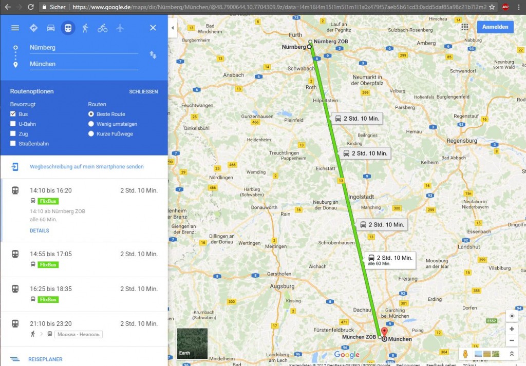
Flixbus-travel with Google Maps
Tip: Flixbus-trip with Google Maps plan in advance
You want to travel in a few days or weeks with Flixbus, you can plan your trip now with Google Maps. To do this, perform the steps above and click the Links on the "trip planner". It is a new window where you can enter your travel time carefully, and then the best connection can be chosen.
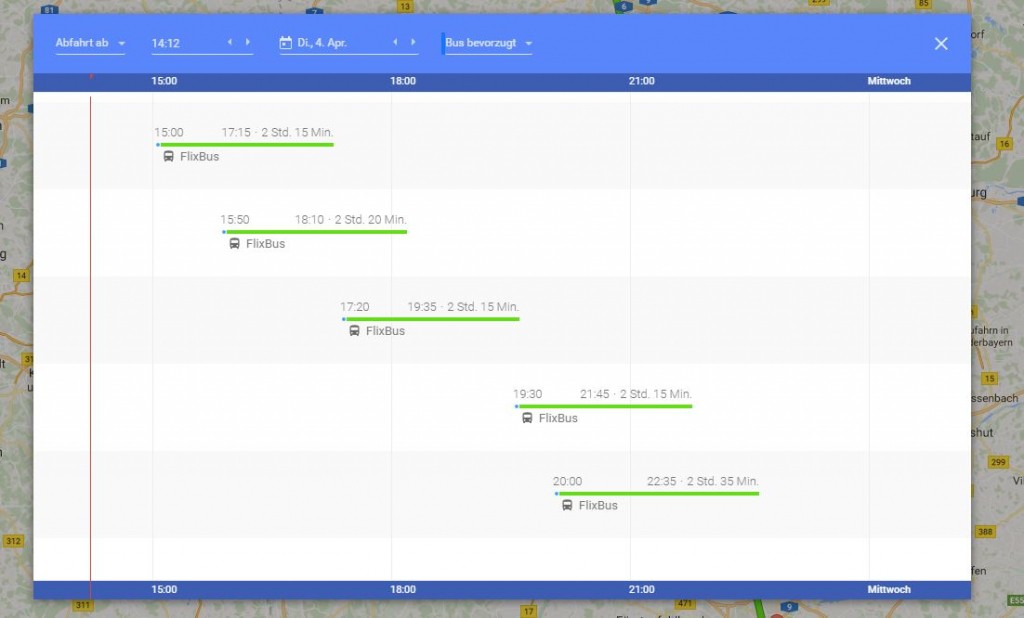
Maps: bus-travel plan
As your newly searched Route in Google Maps, save it for later, we will show in a further practical tip.