This is what you should know: Observe Mars with Google Earth
Google has modified its services so that Google Maps users can no longer just explore the globe virtually. Other planets such as Mars are also integrated into the map program.
- Mars is the destination of many research missions these days. Robots also occasionally send images that make waves in the news broadcasts.
- But the red planet can already be observed in detail using Google Maps.
- Follow our Google link: Mars on Google Maps . A map representation of Mars appears, as we are used to on Earth.
- The planets special geographical locations are highlighted with pins and labels.
- The structures of Mars shown refer to current data from NASA from 2022.
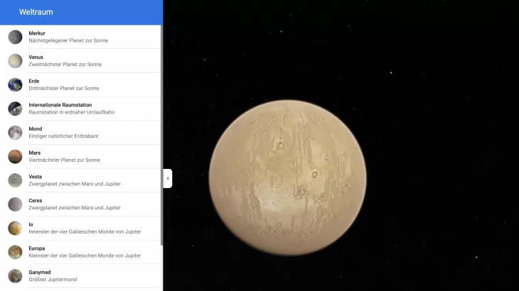
- On the left side you can also inspect other planets and moons by clicking on the three horizontal lines next to Mars.
Collect more information with Google Mars
Mars can be observed closely not only on Google Maps. Further information about the planet is collected on an external platform.
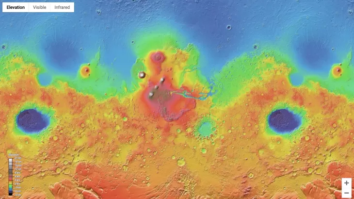
- With Google Mars , an entire page is dedicated to the planet, where regions, mountains or dunes can be viewed based on the latest research results.
- Satellite images that use color markings to illustrate the height differences of Mars give you an impressive overview.
- The locations of research robots and the landing sites of former spacecraft can also be identified and are carefully labeled.
You might also be interested in:
- What is Mars made of? Simply explained
- Gravity on Mars - this is how it differs from that of Earth
- Spiders on Mars: Thats whats behind it